| India Travel and Tourism Information ! |
India | India travel | Cultural Travel to India | Photo Gallery | Incredible India | Pin codes | Travel News | Contact us
|
Home >> Asia >> India >> Maps of India
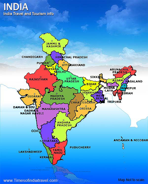
Maps of IndiaMaps of India ! Political map of India; India travel maps, india tourist map, map india, India city map and maps of tourists destinations of India are available for your references. The maps of India page including state maps of India, map of rajasthan, map of Goa, map of Kerala, map of mumbai, map of maharashtra, map of delhi, map of haryana, map of agra, and map of jaipur.
|
Maps of India and India Travel maps! famous destinations of India, Indian tourist places, Map of Taj Mahal India, state travel maps of India, city map\
Explore India with mapsnworld.com Contact us at
© All Right Reserved. mapsnworld.com.