Africa
Otherr African Maps
Annual Rainfall and Monsoon Africa
Temperature and Pressure Africa
Precipitation and winds Africa
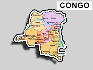
Congo - Democratic Republic of the Congo
Capital: Kinshasa
Congo | Flag of congo | Political map of congo | Where is Congo?
Formerly called Zaire, the Democratic Republic of the Congo declared its independence in 1960 from Belgium that made the country its colony in 1908. However, its initial years were charatcteirsed by political and social instability. In 1965 Col. Joseph Mobutu led a military coup, and became president. Mobutu remained at the helm of affairs for 32 years through several blatantly rigged elections.
The country plunged into turmoil thanks to the influx of refugees in 1994 as a result of ethnic strife and civil war in Rwanda and Burundi. In 1997 the Mobutu rule was overthrown the rebels led by Laurent KABILA who has the support of Rwanda and Uganda. Laurent KABILA fell to the assassin’s bullet in January 2001 and he was succeeded by his son, Joseph Kabila who became the president of the transitional government set up in 2003. He is now the formal president of Congo.
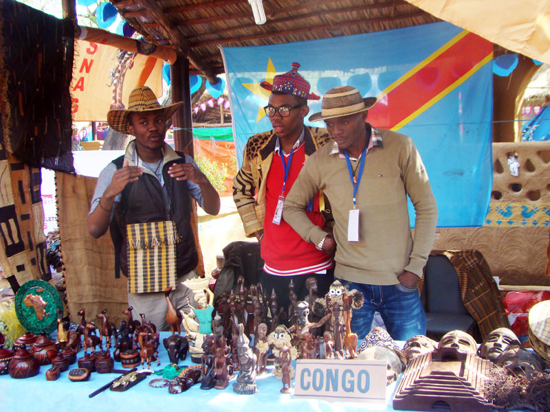
Handicrafts stall Congo, people selling handicrafts made in Congo, Africa
Travel overview
The third largest country in Africa, Congo has all the potential of
emerging as a great travel destination. Vast stretches of savannah,
volcanoes, exotic wildlife make the country a good place to visit.
The capital, Kinshasa, is famous for some fine restaurants.
Capital: Kinshasa
Location: Central Africa, northeast of Angola
Climate: tropical; hot and humid in equatorial river basin; cooler
and drier in southern highlands, cooler and wetter in eastern highlands,
north of Equator - wet season, dry season, south of Equator, - wet
season, dry season
Total Area: 2,345,410 sq km
Total Population: 65,751,512
Population Growth Rate: 3.39%
Sex Ratio: 0.985 male(s)/female
Literacy: 65.5%
Ethnic Groups: over 200 African ethnic groups of which the majority
are Bantu; the four largest tribes - Mongo, Luba, Kongo (all Bantu),
and the Mangbetu-Azande (Hamitic) make up about 45% of the population
Irrigated land: 110 sq km
Languages: French, Lingala, Kingwana, Kiswahili or Swahili), Kikongo,
Tshiluba.
Time Zone: UTC+1
Currency: Congolese franc
Type of govt.: republic
Head of Govt.: Prime Minister Antoine GIZENGA
Major Political Parties: Christian Democrat Party or PDC, Congolese
Rally for Democracy or RCD, Convention of Christian Democrats or CDC,
Forces of Renewal or FR, Movement for the Liberation of the Congo
or MLC, People’s Party for Reconstruction and Democracy or PPRD,
Social Movement for Renewal or MSR, Unified Lumumbist Party or PALU,
Union for Democracy and Social Progress or UDPS, Union of Mobutuist
Democrats or UDEMO
Participation in International Organizations: ACCT, ACP, AfDB, AU,
CEPGL, COMESA, FAO, G-24, G-77, IAEA, IBRD, ICAO, ICCt, ICRM, IDA,
IFAD, IFC, IFRCS, IHO (suspended), ILO, IMF, IMO, Interpol, IOC, IOM,
IPU, ISO, ITU, ITUC, MIGA, NAM, OIF, OPCW, PCA, SADC, UN, UNCTAD,
UNESCO, UNHCR, UNIDO, UNWTO, UPU, WCL, WCO, WFTU, WHO, WIPO, WMO,
WTO
Major Agricultural Products: coffee, sugar, palm oil, rubber, tea,
quinine, cassava (tapioca), palm oil, bananas, root crops, corn, fruits;
wood products
Natural Resources & Minerals: cobalt, copper, niobium, tantalum, petroleum, industrial and gem diamonds, gold, silver, zinc, manganese, tin, uranium, coal, hydropower, timber
Industry & Transport: mining (diamonds, gold, copper, cobalt,
coltan zinc), mineral processing, consumer products (including textiles,
footwear, cigarettes, processed foods and beverages), cement, commercial
ship repair
Airports: 234
Railways: 5,138 km
Roadways:
153,497 km
Waterways: 15,000 km
Major Trade Partners: Belgium 38.2%, US 17.8%, China 11.7%, France
8%, Finland 7.8%, Chile 4.3% (2005) outh Africa 17.7%, Belgium 15.3%,
France 8.6%, Kenya 7.5%, Zambia 6.6%, Germany 4.4%, US 4.3%, Cote
d'Ivoire 4.1% (2005)
Exports: $1.108 billion
Imports: $1.319 billion
People Congo
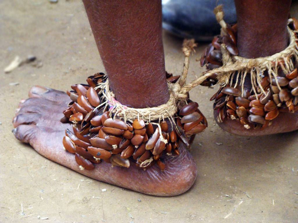
Dancer feets Congo, Aaafraan tribals
Congo people
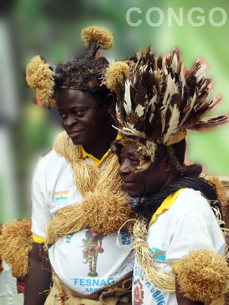
Congo people, tribals
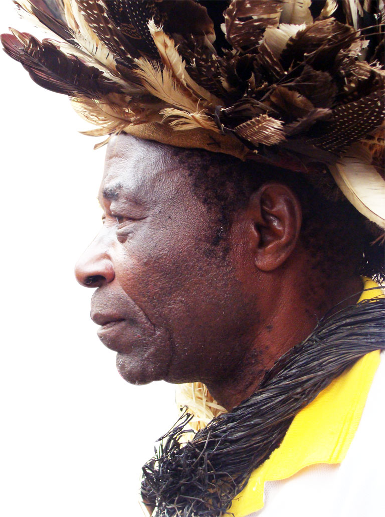
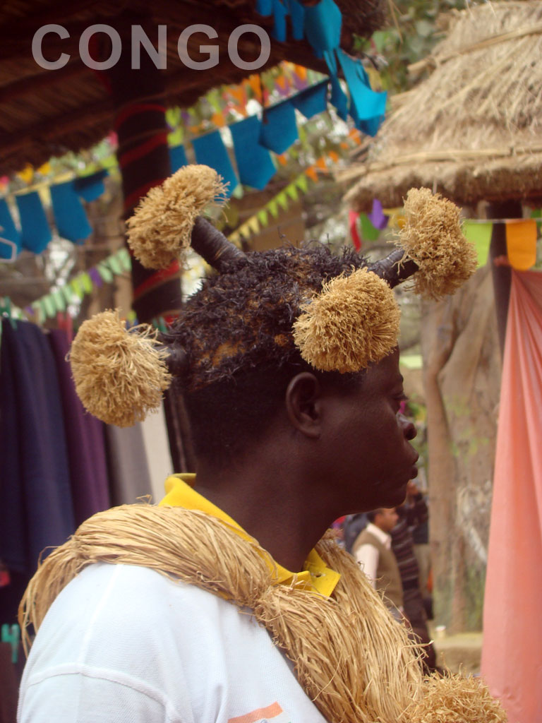
Portrait of a tribal man of Congo, Aafrica
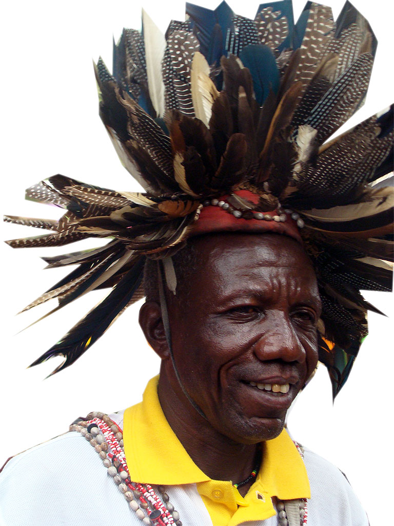
Portrait tribal man wearing feathers on head, Congo
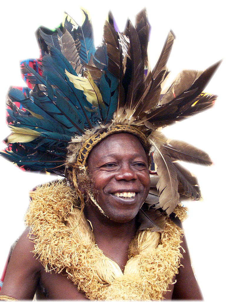
portrait of a tribal man wearing feather on head, Congo