Updated map of India
India | Flag of india | Politiical Map of India
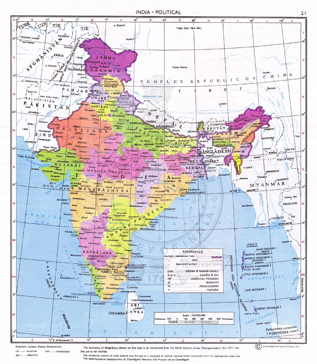
Updated Map of India, 2017, Maps of India with all 29 states, national and international borders, and the map of India shared international borders with Pakistan, Nepal, Bhutan, Tibet, Bangladesh, Myanmar. In this map of India you can find state with largest area is Rajasthan, and most populous state is Uttar Pradesh. States with coastal boundary are West Bengal, Orissa, Andhra Pradesh, Tamilnadu, Kerala, Karnataka, Goa, Maharashtra and Gujarat. States with Himalayas range is Jammu and Kashmir, Himachal Padesh, Uttrakhand. Ganga river Uttar Pradesh, Tajmahal Agra U.P., Khajuraho belong to Madhya Pradesh, Gandhi ji belong to Gujarat, Bollywood- Mumbbai is in Maharashtra, state known as largest agriculture production is Punjab, Bodh Gya belong to Bihar, Chennai is the capital of Tamilnadu, , largest river Brahmaputra belong to Assam, backwaters - Kerala, Beaches Goa and Delhi known for its historical values. So you can find this amazing map of India with important information.
For India travel and tourism information www.mapsnworld.com