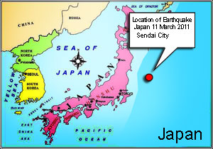
Location map Earthquake Tsunami 2011 japan
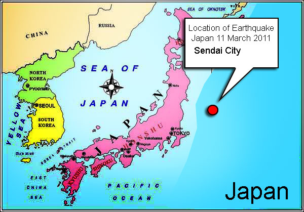
The Sendai Earthquake 2011: it hit the Sendai City majorly
Tohoku region of Japan. and near the coast of the city of Sendai, Earthquake hit Northish-East Japan, but Hokkaido, Tokyo, and other cities of japn felt the quake and near by countries China had also feel the quake.
More than
140,000 people had been evacuated from and around the Fukushima nuclear power plant.
Google crises respone has done a good job by providing important information regarding Japan in the crises. they provide map for affected areas, helpline nos. and other info. (thanks to them)
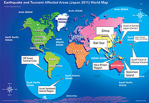
Map of Places affected by Earthquake and Tsunami 2011
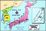
Location map of Earthquake in japan